

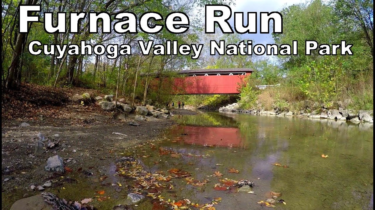
Furnace Run
Furnace Run is located in Brecksville and Broadview Heights in northeast Ohio. It also flows through Richfield and Boston townships to meet the Cuyahoga River at river mile (RM 33.08). It flows 10.4 miles southeast, through Boston and Bath townships, to reach the Cuyahoga River at rivermile (RM 33.08). It drains 35 square miles of primarily suburban lands. An analysis of satellite land cover data from 2001 found that 14 % is considered to be urbanized, with generally impervious surface. The remaining 86 percent of the watershed is primarily comprised of wooded (47%) and grass/agricultural (34%), shrub/scrub (7%) (Cuyahoga River RAP 2004, 2004).
Metroparks Serving Summit County operates Furnace Run Metro Park. It is located in the Furnace Run Watershed. The park currently comprises seven parcels of land that total approximately 870 acres in Richfield. These tracts are separated east-west by Interstate 77 and State Route (SR 21), and Brecksville Road. North-south is by Brush Road or State Route 303. However, two tracts located along Wheatley Road in the south are disconnected from the rest of the park. Furnace Run Watershed is also owned by the Cuyahoga Valley National Park. Furnace Run Metro Park borders Cuyahoga Valley National Park. This park contains 30,000 acres wetland along the Cuyahoga River, from Akron through Cleveland.
LOCATION:
Northeast Ohio, Summit County, and a small part of Cuyahoga County. This includes the communities of Brecksville and Broadview Heights, Richfield Township, Richfield Township, Bath Township, and Boston Township.
ENVIRONMENTAL CONDITIONS
Furnace Run flows into the Cuyahoga River as one of the most healthy and intact streams. Furnace Run was studied in 1991-96 and found that the watershed meets all Ohio EPA standards. Furnace Run contained some sites that exceeded Ohio EPA standards, and were designated “Exceptional Warmwater Habitat (EWH).”
Metroparks Serving Summit County conducted a 2003 study and found that Rock Creek was not in attainment. Despite the fact that the stream habitat was in good condition to support higher-level aquatic life communities and meet Ohio EPA standards it was not in attainment. This was due to the upstream runoff of slag leachate during and immediately after construction of Interstate 80 near this area in 2000-2001 along with channelized stream conditions downstream.
AQUATIC LIFE & HABITAT
This watershed is not in full attainment according to the results of habitat and aquatic life evaluations. The Rock Creek and Furnace Run fish communities meet EPA criteria. However, the aquatic insect community shows signs of impairment. Partially attainment in Rock Creek tributary of Furnace Run can be attributed to past impacts from upstream pollutants sources. From 2003 to 2006, Rock Creek’s aquatic life has been improving. However, Rock Creek’s aquatic life has improved since 2003 to 2006.
In 1999, the Furnace Run mainstem stream restoration area (RM 7.8) was completed. The project involved restoring Furnace Run’s original watercourse to its source after it was diverted to Brushwood Lake. This stream section was restored using soil bioengineering techniques to improve the riparian habitat. Metroparks of Summit County conducted a 2003 survey and found that the area was in PARTIAL attainment for Ohio WQS aquatic life. The 2006 survey, however, found that the area was in FULL attainment. This shows that the restoration of this stream segment has been a success.
WATERSHED HYDROLOGY
Based on visual observations at the sampling sites, significant bank erosion is taking place in Lower Furnace Run. Additionally, there are large amounts of silts/clays that have covered the stream bottom. Gray silts covered the stream’s bottom at RM 4.8, which clearly indicated that it had been eroded from its banks. This could be due to heavy rains, runoff from old and new development, which lack stormwater control.
QUALITY OF WATER
Furnace Run’s water quality is good with data that shows no deviations from standards. Rock Creek, however, is suffering from stress. As evidenced by the high levels of dissolved solids, samples indicate that the stream is being polluted with runoff. The Ohio turnpike interchange construction downstream has led to slag leachate runoff, which is responsible for the decrease in water quality.
Delisting
DELISTING REQUESTED FOR MAJOR PORTIONS OF THE CUYAHOGA RIVER MAIN STEM AND TRIBUTARIES
On April 16, 2009, the Cuyahoga River RAP Coordinating Committee voted to request delisting for fish population and benthos, and to reclassify some previously “unknown” impairments as “not impaired,” along the major portion of the mainstem and in some tributaries.
Here’s how the process works:
• When the International Joint Commission (IJC) of the U.S and Canada mandated the cleanup of the rivers it selected, it assigned the management of the task to each state. In Ohio, the job went to the OhioEPA as the state government agency in charge of pollution monitoring and regulation.
• The OhioEPA then appointed Remedial Action Plan (RAP) groups of stakeholders for each of Ohio’s four designated rivers (the Cuyahoga, Black, Maumee and Ashtabula.)
• The OhioEPA and partners developed its list of Beneficial Use Impairments (BUIs), the criteria for defining whether a BUI was, indeed, impaired or not, and the means by which all or some of an Area of Concern could remove all or some of the BUIs from its “to do” list (delisting.) These lists and criteria were approved by the U.S. EPA as the agency overseeing the RAP program for the United States.
• When a RAP believes its data show that one or more Beneficial Use is no longer impaired, meaning the criteria for “healthy” has been met or exceeded, it may then ask that that impairment be taken off its list, the target having been reached.
This is where we are now, with a few of the Cuyahoga RAP’s BUIs, covering most of the river’s mainstem and some tributaries. Although the criteria and process for delisting a BUI has been set by the OhioEPA, that agency and the RAP, working together, must still gain approval from the U.S. EPA before it can officially delist an impairment.
The request has been made, and indications are that the U.S.EPA will expedite their approval in order to allow the RAP to announce their delisting at the 40th anniversary of the fire on the Cuyahoga, on June 22.
CHIPPEWA CREEK
CHIPPEWA CREEK’s watershed may be among the smaller ones along the lower Cuyahoga River, but it also has one of the steepest grades, and its lands are being quickly urbanized. Steep slopes and loss of wetlands’ water storage capacity means that larger volumes of water move more quickly over the land into tight spaces, the creek rises where water cannot spread out onto a flood plain, and the fast-moving water erodes the soil supporting roads and bridges.
Flooding in recent years has brought attention to the creek’s natural storm water management function, and how land use choices surrounding it have changed the way surface water moves across the area. The watershed is especially important to the health of the Cuyahoga as Chippewa Creek runs through the Metroparks’ Brecksville Reservation and empties into the river in the Cuyahoga Valley National Park.
The Chippewa Creek Watershed Planning Partnership has been formed to address these and other issues affecting the health and welfare of the creek and its environment. The group will study how to balance the need for development of the built environment to support the area’s economy with the need to maintain and restore the natural water management functions of the watershed.
Northeast Ohio, Cuyahoga County, including the communities of Brecksville, Broadview Heights, North Royalton, and small parts of Seven Hills and Parma.

WATERSHED-SPECIFIC CHALLENGES TO HEALTH AND FUNCTION
• Increased volumes of water from …
• larger tracts of impervious surfaces flowing over…
• steep slopes and down the creek’s steep grade, causing…
• faster flows into the creek, creating…
• erosion, sedimentation, and loss of habitat, plus…
• loss of tree canopy in entire watershed, especially riparian zones, and…
• the need for more, and more-widely-distributed, floodwater storage.
GEOLOGY
The Chippewa Creek watershed has formed over the 10,000 years since the glaciers pushed clay and silt down from the great lakes. When the glaciers retreated, they left dense, heavy surface soils that hold moisture and are slow to allow water to permeate. This presents problems for homes that rely on septic systems.
Portions of the creek are lined with a smooth shale bedrock, and others have mixed cobblestone, sand, and gravel. Chippewa Creek carves a deep ravine through Bedford, Cleveland and Chagrin shale layers. In Brecksville Reservation, the bedrock changes to Red Bedford Shale and more erosion-resistant Berea Sandstone. These two shales form features such as Chippewa Falls, undercuts, plunge pools and sandstone boulders strewn throughout the gorge. Appropriately, “Chippewa” is an Algonquian Indian word that means “puckering.”
AQUATIC LIFE AND HABITAT
Chippewa Creek is designated a Warm Water Habitat (WWH) and therefore should be able to support a well-balanced population of fish and aquatic insects. Until the mid-1990s the entire stream was unhealthy and did not support such aquatic communities.
The upper and middle section of the creek, upstream from Brecksville, contains relatively unhealthy fish populations. This can be attributed to polluted runoff from expanding suburban land use, sedimentation from under-managed construction activity and stream bank erosion from increased storm water runoff. Also, waterfalls in Chippewa Creek may inhibit upstream replenishment of fish populations.
As the creek moves into the Brecksville Reservation and the Cuyahoga Valley National Park the health of aquatic life substantially improves. Both parks provide excellent riparian zones, wetlands and cobbled substrates, which together provide a setting in which aquatic communities may flourish.
WATERSHED HYDROLOGY
The level of urbanization -– that is, the amount of generally impervious surfaces such as pavement, roofs and hard-packed lawns – has increased significantly over the past 15 years. In 2001 the watershed contained approximately 23% of this impervious surface, and the trend is accelerating.
As impervious surface coverage grows, the volume and velocity of storm water entering the stream increases. This accelerates the rate of erosion and flooding downstream, impacting aquatic life, public infrastructure and private property.
Attempts to accommodate built environments, such as culverting or burying the stream, only create increased erosion, loss of riparian corridors protecting streambeds, shortening of the stream’s route leaving it less room to handle more water.
The watershed is home to more than a hundred wetlands, which store and release water into the system at a proper rate. As urbanization increases, wetlands are drained and built on, removing important pieces of the natural infrastructure.
WATER QUALITY
Recent reports indicate that Chippewa Creek’s chemical water quality meets Ohio EPA’s standards. In the past, Chippewa Creek suffered from elevated bacteria levels, making the water unsafe for human contact. Recent studies have shown that bacteria levels have improved.
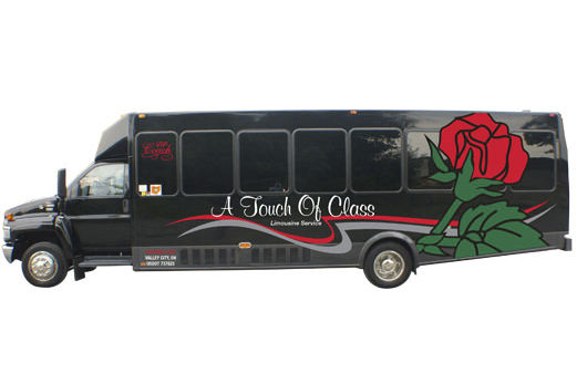
How to Find a Party Bus Rental Cleveland
To make your ride as enjoyable as possible, choose a Cleveland party bus rental company that provides a professional, experienced chauffeur. The chauffeur can also serve as a designated driver, if necessary. Cleveland party bus rentals are great for any occasion and come with up to four hours of continuous shuttle time. The best part is that they are inexpensive. You can even find a limo that is smaller than a regular passenger vehicle, and you can even request a Hummer limo!
Moovit is a great app for public transit
Moovit is a fantastic app that guides you to and from your party bus rental Cleveland. With real-time arrival times for buses and trains around the world, Moovit helps you plan your trip in confidence. Not only does it give you the latest bus and train schedules, but it also includes real-time get-off alerts. And because it’s available in more than 45 languages, you’ll never get lost on a trip.

3 Kings Limousine is a party bus rental company in Cleveland
If you want to make your special event unforgettable, you need to hire a limo. At 3 Kings Limousine, you can get a limo that has all of the luxuries you can imagine, plus it takes all the stress out of planning. The drivers of these vehicles are courteous, professional, and have the skills to plan impromptu routes for you. If you want to celebrate a birthday in style, you can choose from a limo party bus or stretch Audi Q7.
Unlimited Charters is a party bus rental company in Cleveland
When you are hosting a big event, a party bus can add class and luxury to the experience. Platinum Limousine Service provides the best service and the latest buses with top-notch chauffeurs. Whether you are tying the knot, planning a birthday party, or need transportation for a business event, a party bus rental can make your night a hit. Whether you need a luxury party bus for a wedding or a bachelor party, Platinum Limousine Service has the right vehicle for your needs.
Hummer Limos
Whether you are celebrating a birthday, bachelor or bachelorette party, or just looking to make a big entrance at an event, a Hummer Limo is a great way to travel in style. You can find a Cleveland, OH limo rental at The Bash, a database of transportation providers. Each company has verified reviews and thousands of ratings. Booking through The Bash is completely free, and all payments are processed securely online. You’re also covered by Our Guarantee, which means you can rest easy knowing your booking is in good hands.
Cadillac Escalades
If you are looking for a luxurious limousine, there are many options available to you when it comes to party bus rentals in Cleveland. If you have a large group, a Cadillac Escalade limousine is an excellent choice, as it offers a large amount of space and can accommodate up to 20 passengers. Escalade limos are also available for corporate events, and are the perfect way to transport employees from a corporate function to a work party or convention.


Chrysler 300s
The first consideration in hiring a party bus rental is the size of the group you are transporting. Obviously, larger vehicles are more expensive, but the right party bus for your group size can cost less. Large groups can also share a single vehicle. The price also varies depending on the time of year, so if your party is especially large, you might want to choose several buses instead of one. In addition, you may want to consider how many hours you need the bus for.
Mercedes Benz Sprinters
If you are looking for a luxury van that seats up to 14 people, a Mercedes Benz Sprinter may be the right vehicle for you. Its interior ambiance is unparalleled, and it has a comfortable seating arrangement with plenty of legroom. This party bus also features a TV and DVD player, and it is sure to be a hit at any party. This party bus rental Cleveland vehicle has many extras, including a dance floor and a DVD player.
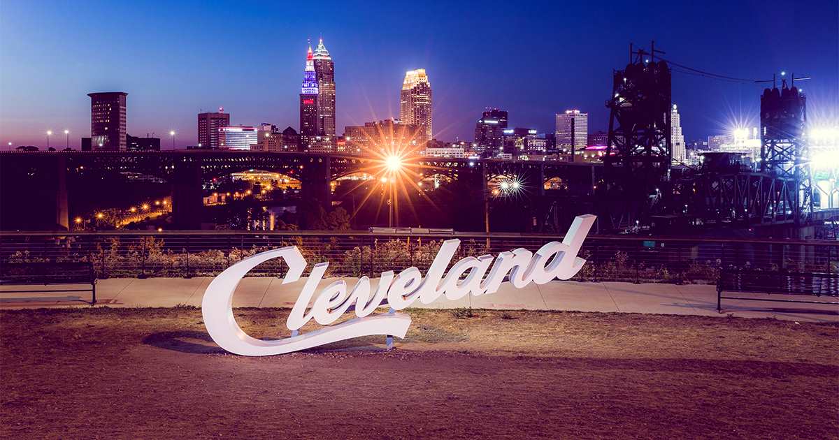
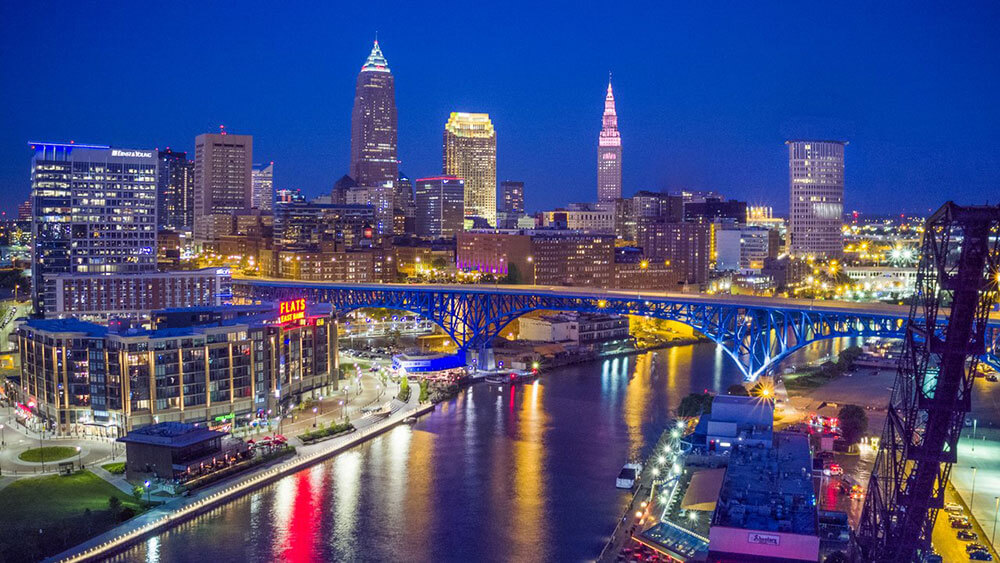
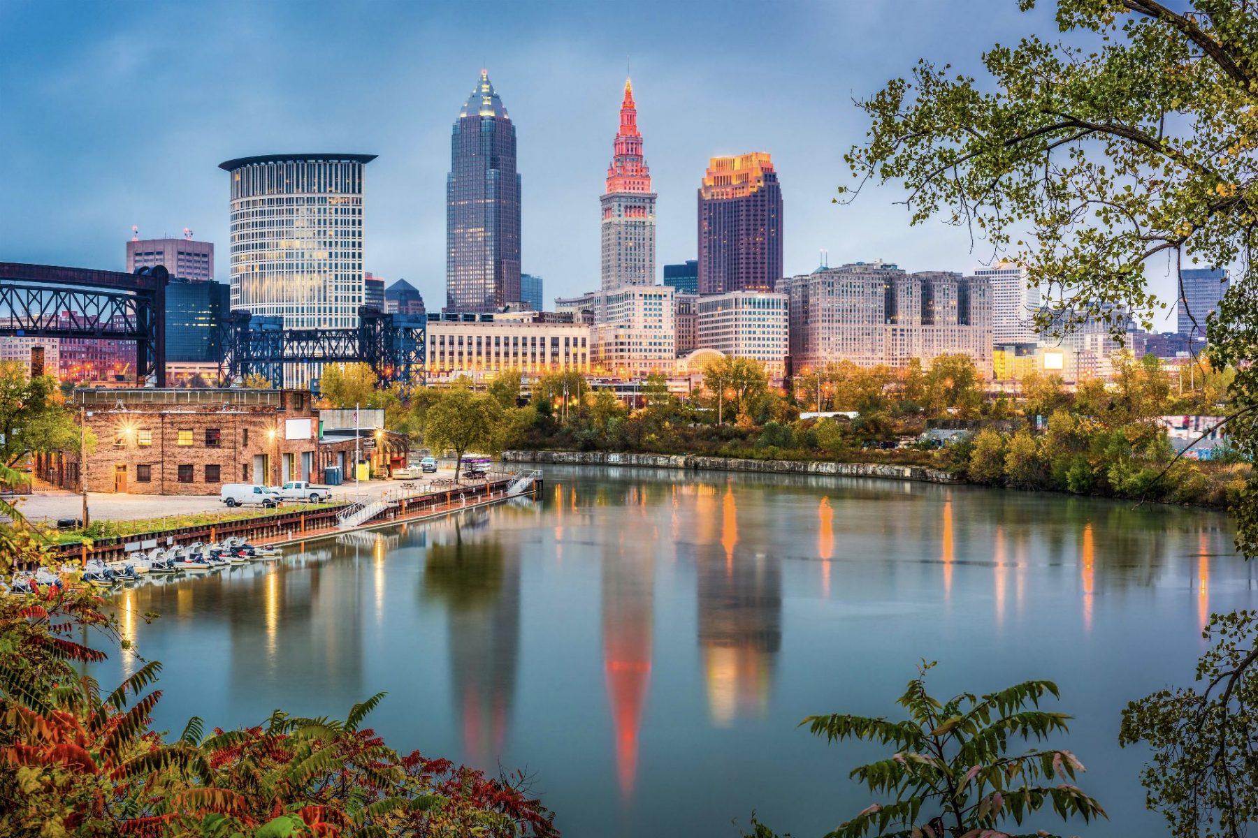
Cleveland Tourism: Five Must-See Places in Cleveland, Ohio
The tourism industry in Cleveland has been experiencing a recovery period that will take years to achieve its pre-pandemic levels. Although it is not expected to return to pre-pandemic levels until 2024, the city’s tourism industry is reshaping faster than the national industry. This early recovery will be more psychological and longer-lasting than physical. Here are a few points to consider when visiting Cleveland. The Rock and Roll Hall of Fame, West Side Market, and the International Women’s Air and Space Museum are all worth seeing.
Rock and Roll Hall of Fame
When considering a trip to Cleveland, be sure to check out the Rock and Roll Hall of Fame. Also known as the Rock Hall, this world-famous museum is located in downtown Cleveland, Ohio, on the shores of Lake Erie. It is an amazing place to see how much rock and roll shaped the history of our country. If you have never been to Cleveland, you’re in for a treat.
West Side Market
The West Side Market is one of the oldest operating indoor/outdoor market spaces in Cleveland, Ohio. Located on West 25th Street and Lorain Avenue in the Ohio City neighborhood, it was listed on the National Register of Historic Places on December 18, 1973. Since its restoration in 1997, the market has been a popular destination for locals and tourists. You can visit this market in its entirety or just browse through the merchandise.
International Women’s Air and Space Museum
If you’re looking for a unique and educational experience, look no further than the International Women’s Air and Space Museum in Cleveland, Ohio. The museum is dedicated to preserving the history of women in aviation and space, as well as documenting the contributions of women today. The exhibits are both informative and entertaining. You’ll learn about everything from astronauts to the history of flight to women’s contributions in the world today.
SPACES art gallery
Despite the city’s burgeoning creative economy, it remains a mystery why SPACES art gallery is not more popular, especially among the younger generation. The space has a reputation for showing works of diverse artists, but its members are overwhelmingly white. This is in part due to the resurgence of downtown Cleveland as a tourist destination. But the resulting cultural divide in Cleveland is likely to continue to affect the art scene in the region for years.
Transformer Station
A contemporary cultural hub in Cleveland’s Ohio City neighborhood is on the rise, and that includes the newly renovated Transformer Station. This 1924 station is a landmark, and its minimalist addition is a striking contrast to the historic surrounding area. The new space is open to the public on Wednesdays through Sundays and features art exhibitions and community events. The Cleveland Museum of Art and the Bidwell Foundation present the exhibitions, and the center aims to be a community think tank and laboratory for creativity.
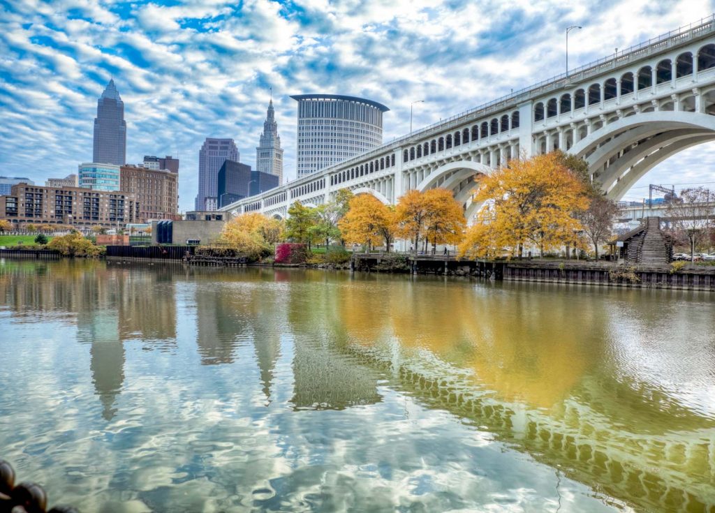
The Cuyahoga River and the Removal of the Gorge Dam
When the blaze in the Cuyahoga River took place in 1952, the event did not immediately grab national headlines. The next day’s Cleveland Plain Dealer reported on the blaze in just six paragraphs. However, the Cuyahoga River would become famous when an article published in Time magazine in 1969 discussed the ecological crisis in the United States and featured a photo of the blaze. This dramatic photograph of the fire and its devastating effects drew widespread attention to the area.
Restoration of the Cuyahoga River
The restoration of the Cuyahoga River will restore the natural ecosystem and reduce erosion along its shoreline. This work will also improve water quality and protect the habitats of fish and wildlife. The project will also help improve recreational opportunities and support the Great Lakes ecosystem. The restoration work will be completed by 2021. During this time, there will be post-restoration monitoring and assessments to determine the effects of the restoration efforts.
The new name for the nonprofit Cuyahoga River Community Planning is Cuyahoga River Restoration. The nonprofit organization is a facilitating organization for the Cuyahoga River Area of Concern. The Ohio EPA created the CRAC in 1988 to promote the restoration and protection of the river. The nonprofit organization’s role is to help direct funds to the various projects and programs aimed at improving the Cuyahoga River. Aside from that, the organization also provides technical assistance and educational materials.
Impacts of water pollution on lakes
The Cuyahoga River runs through Ohio, empties into Lake Erie, and supports a densely populated urban area. In 1969, when the river burned, the Cuyahoga River became a symbol of water pollution. In response, lawmakers passed the Clean Water Act, which has helped the river recover significantly. Now, the Cuyahoga River is undergoing a rebirth.
Water pollution has been a growing problem in the U.S. for a long time. The Cuyahoga River, which runs from Akron to Lake Erie, was one of the most polluted waterways in the country. The EPA ranked it the third most polluted river in the United States in 2011. In 2010, the Cuyahoga received 2207,491 pounds of toxic discharges from six states. The EPA’s Toxic Pollution of America’s Waters Executive Summary shows that the river is filled with chemicals, viruses, bacteria, and parasites.

Impacts of removal of the Gorge Dam
The removal of the Gorge Dam will restore historic free-flowing conditions along the Cuyahoga River corridor. Not only will this project benefit the region’s fish and wildlife populations, but it will also improve the landscape and aesthetics of the AOC. The project could start as early as 2023. In the meantime, there are several questions about the project’s potential impacts. To answer those questions, we need to first look at what’s at stake in the removal process.
In 2015, Tetra Tech estimated that removing the Gorge Dam would cost $70 million, but the actual cost is unknown. The Ohio Environmental Protection Agency said that the river’s aquatic habitat is deteriorating. However, the dam’s removal is not without its own problems. The Cuyahoga River is a National Historic Landmark and will be preserved as a pristine area for generations to come.